Overview
OS MasterMap Sites Layer
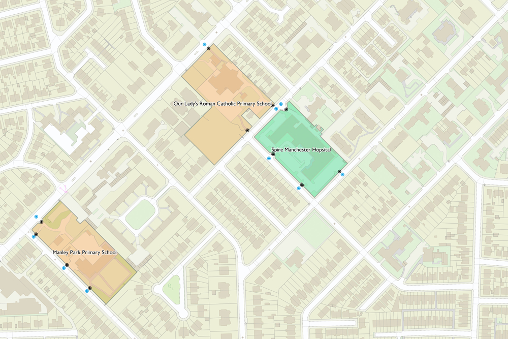
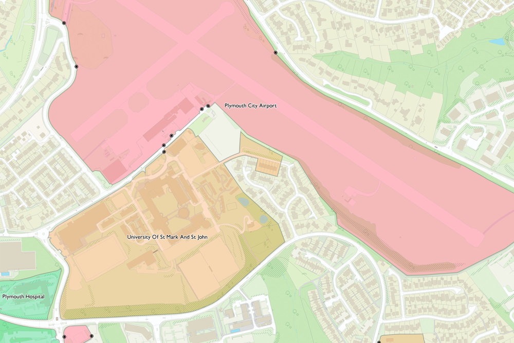
OS MasterMap Sites Layer shows what people see in the real world, where the common view of something (such as a school) is not the address, the main building or the playing fields, but is the site as a whole.
Accurate risk analysis
OS MasterMap Sites Layer gives you an understanding of the wider geographic perspective. For example, how assets interact with specific types of sites (for example, schools).
Find relevant access points
Identify where the most appropriate access points into a site are, enabling more detailed planning for emergency situations.
Enhanced analytics
OS MasterMap Sites Layer routing points enable more efficient responses and more effective deployment of resources.
Features grouped into seven different themes
The OS MasterMap Sites Layer groups features into seven themes:
- Air transport
- Education
- Medical care
- Rail transport
- Road transport
- Water transport
- Utility or industrial
Each feature is available as three feature types: functional site, access point and routing point.
More accurate analytics
OS MasterMap Sites Layer can help you answer questions like ‘How close is this school to something?’ or ‘What would be affected in the event of an emergency?’.
How to get this product
Technical specification
| Key Features | What this product offers |
|---|---|
| Theme | Education, medical care, rail transport, road transport, water transport, utility, and industrial. |
| Format | GeoPackage, Vector Tiles and GML. |
| Update frequency | Six monthly (April and October) |
| Supply | Online download |
| Coverage | Great Britain (order 5km2 tiles to cover your Topography Layer area of interest). |
| Support documentation |